In which our intrepid hero hopes that oil’s well that ends well…
Fracking concerns me, I admit it. I should hasten to point out that I do not, as many do, oppose fracking, no more than I oppose genetically modified crops. But I believe both technologies should be treated prudently, with an eye towards identifying and preventing problems. I am concerned about groundwater contamination, I am concerned about earthquakes. I can only hope that Ohio is wise enough to create a good regulatory and oversight foundation and will be proactive enough to try to deal with potential problems before they become actual ones.
Beyond that, though, I am concerned about something that it may not be within the power of the state of Ohio to regulate, and that is that Ohioans themselves will not benefit enough from fracking. One would think that it is a rare blessing that Ohio’s deposits are located in the economically blighted Ohio Appalachia; those areas certainly deserve a break, right? Yet it is those same areas that have Ohio’s traditional oil deposits as well, as can be seen by the hundreds and hundreds of wells dotting the countryside. And that traditional oil wealth seems not to have benefited eastern Ohioans much at all—so will fracking do so, or will the gains simply be siphoned out of the state, much like Ohio’s gambling money largely is? I hope the people who need the money the most get some of it.
[Remember that you can click on each image below to see a larger, better version]
With this blog entry, I continue my 21st excursion into the southeastern Ohio countryside, in early November 2013, taking photographs with a decidedly pastoral feel about them. It is past harvest season but still very much part of fracking season, with pipelines being buried across the countryside and many other signs of the very much real fracking boom.

I thought this hillside barn was a quite striking structure. This place was not deserted, it actually had some cattle.

Here we have Olive Lodge No. 210, Mt. Ephraim, Ohio, built in 1911. Mt. Ephraim is a tiny unincorporated area in southeastern Ohio. You can tell how small it is by noting that its larger counterpart, Sarahsville, Ohio, has only around 160 residents. This Masonic lodge actually still seems to be in operation. It began in 1851 in Sarahsville, then moved to Mt. Ephraim in 1908. The building itself is a little odd—my brain wants it to be symmetrical, but it is not.

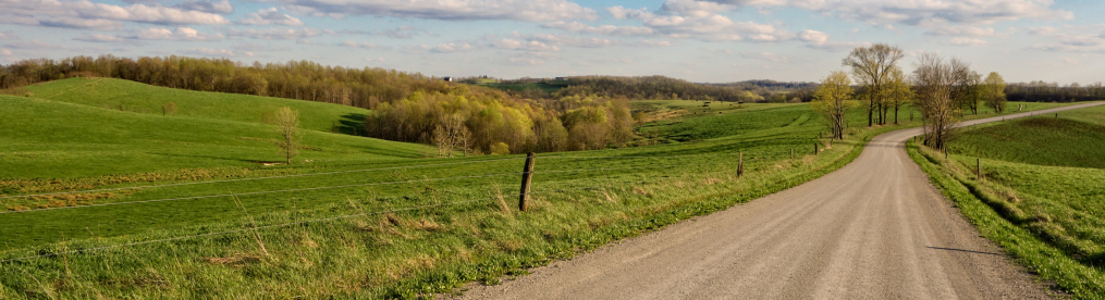
When you drive through the wooded hills of southeastern Ohio, you sometimes find things hidden away in the woods, like this little piece of pastureland and accompanying old barn.

With pastureland, of course, you have cows. This particular bovine specimen has escaped her pasture and is standing on the side of the road, looking somewhat proud of herself. I have seen such elusive cattle several times now. In none of those cases was there a nearby farmhouse that would have clearly been the owner, so I have not yet been able to notify someone that one or more of their cattle were loose. I suspect even if they escape the fence they probably stick close by, though.

Some more pastureland, with the bed of a little creeklet (now dry) running through it.

I find it rather odd how often I find these tiny old tractors abandoned in fields or pretty much anywhere.

You can see how attractive farms can be in southeastern Ohio when well kept up. Wouldn’t you like to have some actual woods in your back yard?

One of the advantages of driving through hill country in Ohio is that you are occasionally afforded a nice view—especially if trees are now bare of leaves. Here we see a typical southeastern Ohio farming vale, with a little cluster of homes and buildings probably too small to have a name.

In Ohio, it is the Utica Shale from where fracking gets its gas. In 2013, CONSOL Energy and Hess Corporation drilled two sets of three wells in Noble County, NBL11 and NBL33. Production was expected to have commenced by early 2014 at the latest. I believe these are horizontal rigs, stretching out nearly a mile from their central location.

Here we see part of a pipeline and a little station set up for work on it. I was majorly tempted to try to stop and use the san-o-can there, but the presence of a vehicle in the vicinity deterred me, so I took my bladder elsewhere.

Another little cluster of houses and buildings, as seen by an overlooking hillside.

Same place but from a different angle, further along the ridge.

This ancient abandoned building was one of the odder sites I’ve seen. Note that there is a tight web of trees enclosing the building, then bare grass beyond. It is almost like a pack of carnivorous trees peeled this house away from the herd and are now snacking on its bloody remains.

Some more pastureland under the dome of a southeastern Ohio sky.

You never know what the next twist in the road will bring you. I turned around one bend to find this deserted house looming over me like a haunted sentinel.

Here is another old house, still somewhat stately though it has bleak surroundings.

Some southeastern Ohioans are quite happy about the fracking boom, hoping it will help revive a region desperately in need of some economic revival. But others are none too enthusiastic about fracking, uncertain about whether it will do more harm than good. Nobody wants to wake up one day and discover that it is possible to use a cigarette lighter to light one’s tapwater on fire.

Another abandoned home—there is a more modern home hidden behind it. I had a chance to to talk to the owner of the property, who informed me that this house is well over a hundred years old. However, it won’t be around much longer, as he will be tearing it down. This whole area was flooded not that long ago; there is a creek (possibly the East Fork of Duck Creek) across the road from this house and, while smallish normally, apparently at flood stage it can become a monster.

This is the one-time Methodist Church of Harriettsville, founded in 1870. Harriettsville is a tiny unincorporated community in Noble County; based on the number of buildings it has, I’m guessing a population of maybe 90 or 100. It also has a really nice-looking Catholic Church, but I did not care for the quality of my image of it.

Just one more abandoned farmhouse next to the road. This blog entry is like a cemetery for farmhouses, isn’t it?

After I started heading back north, home to Columbus, to wrap this excursion up, I came across a small park (closed, alas) with a statue depicting a huge piece of coal mining machinery. This turned out to be Miner’s Memorial Park and the statue turned out not to be a statue but rather the actual Big Muskie Bucket. I want to say that this makes it an extraordinarily large piece of machinery (weighing 460,000 pounds when empty), but then I saw a photograph of the piece of machinery, the Big Muskie itself, which used this bucket. Together they must have been one of the largest shovels the world has ever seen. The Big Muskie weighed 13,000 tons and was nearly 22 stories tall. It operated from 1969 to 1991, but was still on-site as late as 1999 (though it was later dismantled and scrapped by the end of that year).
The Big Muskie was an impressive engineering achievement, no doubt, but it was used to strip mine, which takes a little of its sheen away, as far as I am concerned. This memorial is essentially part of a major public relations campaign by American Electric Power, which (through its Central Ohio Coal Company) was responsible for much of the coal strip-mining operations in Ohio. Federal and state laws passed in the second half of the 20th century mandated that strip-mining companies engage in reclamation of the lands they destroyed. AEP turned some of this area into a recreation area they dubbed “ReCreation Land.” It has become a popular recreation destination in Ohio and has been much trumped by AEP’s public relations people for environmental image reasons.
Miner’s Memorial Park was originally named after a Central Ohio Coal Company executive until someone apparently realized this wasn’t the best public relations idea, so it was renamed after the miners. Although a state site, the historical marker for the Park seems clearly written by AEP. It talks about how the “robust coal industry” was “hit hard by environmental regulations” that caused mining to decline and local businesses to close. The marker says nothing about the coal being high-sulfur coal that was not in high demand, nor about the environmental toll. The back of the marker is simply a paen to AEP for ReCreation Land. It would have been nice to have had a true historical marker written to memorialize Ohio’s miners, talking about the bad working and safety conditions, the many miners who were injured or died (or died young; I myself have a number of people in my family who died of black lung diseases in Pennsylvania), or the United Mine Workers, founded in Ohio. But I guess AEP wouldn’t like that.

Enough with my ranting. Let’s get back to pastoral hillside scenes, shall we? Mooo and all that.

McConnelsville, Ohio, population 1,784 (salute!) is an attractive village that serves as the county seat for Morgan County. It boasts some well-kept-up old buildings, including the impressively solid Morris Hardware store (note the equally impressive fire-escape).

Almost all towns in Ohio have some sort of war memorial, or more than one. Here is McConnelsville’s Civil War memorial. For more than a quarter century, the village has sponsored “Civil War Encampment Days,” bringing re-enactors together from around the region and featuring a mock battle.

I do consider all of the ideas you have
offered on your post. They’re very convincing and
will certainly work. Still, the posts are too quick for newbies.
Could you please extend them a bit from next time?
Thank you for the post.