Growing up in West Texas, as I did, I acquired the habit of looking down over the railings every time I drove over a bridge. The reason why, of course, was to see if there was any water in the arroyo or canyon or streambed or riverbed below—because more often than not, there wasn’t. If you did see some water, it was like a pleasant little surprise, something always to be remarked upon as you drove past. In Ohio, of course, there’s always water under the bridge, but it took me many years for my subconscious to pick up on that, because I was always looking.
[Remember that you can click on each image below to see a larger, better image. Also, the EXIF data for each image contains GPS coordinates that you can use to locate the exact place where the photograph was taken. Copyright information: All of the text and images on this blog are the intellectual property of Mark Pitcavage. Attributed, non-commercial (ONLY) usage is permitted under the Creative Commons License.]
That habit of my younger years came back to me while I was reviewing these photographs—taken in February 2016 as the second half of an excursion into the area of southern Ohio stretching south and eastwards from Cincinnati—as many of the photographs feature streams. Not only that, but most of the share the common theme of having to cross those various streams to get to something, usually a dwelling.

Being close to a major river like the Ohio River, one is going to run into various other rivers, creeks and streams as tributaries. Usually that means you will see a lot of bridges, often small one-lane bridges. But occasionally, very occasionally, you might see something else. Here is one of those rare occasions, where the road (at a place with a sign that reads “Miller’s Crossing”) actually simply goes right across the stream—in this case, Big Threemile Creek. It is interesting, because whoever constructed this simply put a layer of paving across the flat-rock bottom of the creek, allowing the creek to simply flow right over it. Very picturesque, too, though if the waters rise, people will be stranded.

Here’s a shot from that road, looking down the creek. You can see the various mini-waterfalls caused by the drops in its sheet-like bottom. I never could tell if this road was a “real road,” in the sense of a byway maintained by some level of government, or a private road, like an extended driveway. It extended across more than one property, but all the properties have an address on SR 41, so I am leaning towards private road.

Not too much further down the road, where another creek, Meffords Run, seems to run into Big Threemile Creek deep in these sparsely populated wooded hills of southern Ohio, we see a somewhat more daunting cross-stream prospect. Anyone wanting to get to the small camper on the far side of this stream will have to cross the stream itself. The bottom looks fairly rocky, as one can see, so hopefully the odds of bogging would be low, but I did not chance it.

These streams and creeks can be formidable obstacles for those people who live across them from the main road. Even something as simple as going to check one’s mail may require elaborate construction, as here. I have documented a number of these “mail bridges,” as I like to call them, across southern and eastern Ohio.

I took this photo from a different angle to give more perspective, both on how long this little pedestrian bridge actually is, as well as what exactly it is crossing. Note that this is also another example of a place where a vehicle has to physically drive into the stream in order to get to the house on the other side. This is one of those irritating instances in which my camera GPS did not record the location (either the battery ran out or I accidentally hit the off switch, I can’t remember), so I cannot tell you exactly where it is, other than to say somewhere along Big Threemile Creek.

Somewhere in the same general vicinity was this small brick cabin—can one call it a cabin if it is made of brick? Note that, though the house is very small, it still has two separate front doors. Many old houses in rural Ohio have two front doors. I have tried to find the reason why and, although I have come across a host of different attempts at explanation, they tend to range from the dubious to the ridiculous in terms of believability. So I am still honestly not sure why they exist like this.

It is an unfortunate fact that there is a considerable amount of poverty in this area of Ohio Appalachia and a number of the residences reflect it, with many of them resembling houses that were cobbled together from spare parts.

Also common are spartan-like mobile homes, such as this example, parked on a thin stretch of almost-level ground between the road and a drop-off.

Here we come across another cross-the-creek conundrum. To get to this small abandoned house, we have to physically drive into the creek. And, though once again the stream bed looks fairly rocky, I say that with the benefit of hindsight and the ability to scrutinize photographs. From the vantage point of my SUV at the time, I was not particularly interested in trying it.

We can see from the muddy tracks that someone did recently cross the creek to get to the abandoned farmstead on the other side. Here the problem seems to be not necessarily the creek itself, but the soft and water-sogged ground between the creek and the road.

In rural America, the great outdoors is often little more than one huge dumping ground for anything one is too lazy to haul away. Old schoolbuses, derelict boats, and obsolete farm equipment can all be found littered in abundance. Want to know how long some of this stuff has been lying around? Long enough for a tree to grow up and through it, that’s how long.

Here’s another example of a cobbled-together sort of dwelling.

I’m curious what this area used to look like. Clearly there was some sort of structure, now ruined, next to the road, and next to that structure was a wooden plank bridge crossing the stream. But that was all clearly some years ago.

Here we have a combination of a cobbled-together structure along with a serious dumping ground.

After all that country living, it is time for some city life. Or hamlet life. Here we see the post office at Bentonville, Ohio, a tiny unincorporated community with a population of some 327 (salute!). Note the signs next to the mail drop that together inform the reader that this location was once the location of the oldest postmaster in the United States, Verna Naylor, who lived from 1915 to 2010. She was postmaster for more than 40 years, having taken up the position after the death of her husband, who was postmaster before her (for 20 years, in fact). The post office was run from a room in her home, which I presume we also see here.

Bentonville whetted my appetite for big city life, so I traveled to West Union, Ohio, the county seat for Adams County, and a village with a population of 3,241 (salute!). One building in particular in West Union caught my eye, the “Adams County Senior Center & Nutrition Site.” I cannot imagine many seniors trying to go up or down the extremely rare external spiral staircase that winds its way up to the second floor of this building. The odd tree that somehow springs forth from the foundation opposite the staircase is almost as interesting.
As an aside, if you’ll look closely at the building next to the Senior Center, you will see the office of John Lawler, Attorney at Law. John was clearly destined for his profession at birth.

This abandoned property in West Union caught my eye because of the unusual second floor architecture, with its second floor porch and recessed upper structure that includes a rounded corner.

From West Union I travelled for some ways eastward, without taking any photographs, until I arrived in the vicinity of Lucasville, Ohio, Located in southern Ohio along the flood plains of the Scioto River, Lucasville—despite having a population of some 2,757 (salute!)—is only a “census-designated location,” which means that it is unincorporated and is not officially even a village. It more or less doesn’t exist. Ohio has many census-designated locations, but this is the largest one, in population, that I have come across.
I suspect many Lucasville residents are employed by the institution with which almost all Ohioans associate Lucasville: the Southern Ohio Correctional Facility, often referred to as Lucasville Prison. Pictured here, the Southern Ohio Correctional Facility (SOCF) is a maximum security prison (second in security only to the “supermax” prison located in Youngstown). SOCF is also the place where condemned Ohio prisoners are actually executed (though for some reason most death row inmates actually are housed in a prison near Chillicothe until their execution date).
I first became aware of “Lucasville” in 1993, about five years after I moved to Ohio, when it became the scene for a notorious and deadly prison riot, a massive 10-day riot (allegedly the longest prison riot in U.S. history), in which prisoners, largely led by gangs such as the Ohio Aryan Brotherhood and the Gangster Disciples, took over much of the prison. Nine inmates died during the riots, as well as one guard, who was deliberately killed while a hostage as an act of retaliation against authorities whom inmates believed were not taking them seriously.
I drove into the parking lot of the prison to take some closer shots but either there was a sign that said photography prohibited or a guard told me that (I forget which) and I decided not to press the issue.

East of Lucasville a ways was a business that carved gravestones. I had not seen memorials like these before. While as an alumnus I have no problem with the Ohio State headstone, I had not seen any stones like the others before. They all display kitschy scenes and have a sort of black velvet painting look to them and I do not like them. Give me a plain old headstone any day, with the epitaph: “Here lies Mark Pitcavage…I know, he doesn’t care, either.”

I continued driving east, through southern Ohio, coming across this very makeshift house in Scioto County. Scioto County is among the poorest counties in Ohio, and all the other poorest counties, except one, are its neighbors. The one exception is Holmes County, which is located in northeast Ohio and is the heart of Amish country in Ohio. I believe the large Amish population is the reason for this apparent discrepancy, as the region is fairly prosperous, with low unemployment. But the Amish have larger families and rely on barter and sharing to an unusual degree and thus in some respects take part less in the cash economy. For these and other reasons, statistics alone sometimes produce misleading results where high Amish populations are concerned. But I digress. Back to southern Ohio.

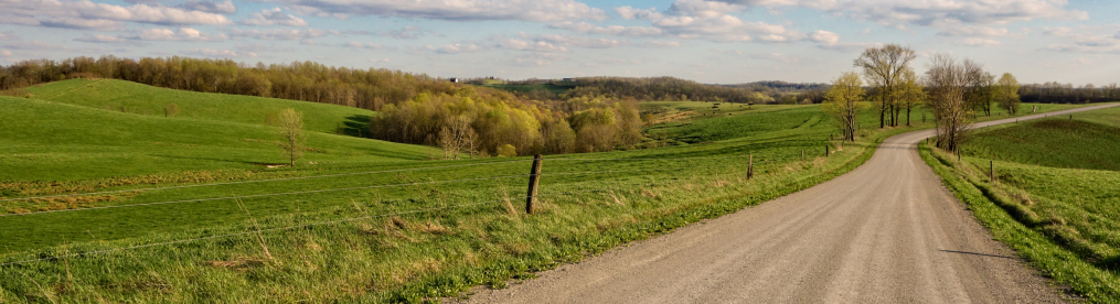
Though southern Ohio in general is fairly hilly and wooded, it has stretches that are flatter and more open. Here we see an area (maybe 10 miles southwest of Jackson) that is quite open, consisting mostly of low, rolling slopes. In the distance, at the top of one of these low hills, is a little cemetery with around 10-20 graves.

I found this old shack not too far way. Note that it, too, has two front doors.

Here is a fairly well-preserved little wood building, presumably a former one-room schoolhouse. The sign over the door says “Scioto Township 1876.”

Soon enough, I was in Jackson, Ohio, the county seat of Jackson County, a virtual metropolis compared to the other places here, with a population of 6,397 (salute!). Like any county seat, it is centered around a courthouse, shown here.

By the time I reached Jackson I was already headed north and with the winter sun dipping low, became more interested in getting back home than photography. I drove all the way from Jackson north to Chillicothe without much in the way of photos. But there were a few scenes northwest of Chillicothe where I decided to stop and take a shot or two. One was this roadside windmill.

I also stopped when I saw this old country house, with its grand tree, set against the setting sun. I thought that was worth a photograph.

One final shot here shows that I was definitely out of southern Ohio and back into the flat farmlands of central Ohio, or at least its southern edges. Here, of course, is YAORSH (Yet Another One-Room Schoolhouse).
And that’s it!

I love your website and your articles. Being from a very small Ohio town myself, I love to browse the pictures and reminisce about myour youth. If you ever get around Bridgeport, Ohio, See if you can find some history on a small area known as Boydsville. My grandparents spent there whole lives there, immigrants. I would love to know more:’)
Thanks for your kind words! I have been through Bridgeport but I don’t know that I took any photos–I will have to get back there. I love the area.
Very interesting pictures, Mark.
Thank you!