In which our intrepid hero discovers a perilous way to check the mail…
There’s a sort of development that I call “strip” development. I am not referring to a strip mall but rather to an artifact of terrain. There are many places across the country where there is only a small area of relatively flat land, backed up against a hill or mountain. On the other side is perhaps a river or maybe another hill. Along this terrain meanders a road, with a continuous train of buildings and houses constructed in that narrow strip of land between the road and the hill. You can’t develop to the back, so you just keep on building to the side in a long, thin strip. In regions dominated by hilly or mountainous terrain this sort of development is extremely common.
[Remember that you can click on all the pictures below for better, larger versions]
The below photograph, of the “7 Inn,” is an example of strip development. Buildings in front, hill in back. Facing the hotel, on the other side of the road is a highway, and beyond that the Ohio River. The 7 Inn was outside of Bellaire (see previous entry). Above 7 Inn it says “Shady Bell,” but I am not sure what to make of it. The motel was built in the late 1950s; someone else has taken a better picture of it (I am not sure why I did not pull in the parking lot and spend more time at this place). It may have declined once State Route 7 became a freeway or it may have been part of the general decline of Bellaire.

This photo of a NAPA store is a good example of something that in all likelihood will interest only me. Something about the brick building, with its interesting steps, just caught my fancy and transported me back to a time when every store did not necessarily look like every other store.

That’s the Ohio River running between the grass in the foreground and the bluffs in the background. You may be wondering why I don’t have more shots of the Ohio River and that is because, sadly, there is not much to photograph. Ohio sadly put a highway right alongside the river for much of its route, with little opportunity to use the river for recreation. I sometimes get the sense that they consider the Ohio River more of an “industrial” river—intended for use by big business (mining, freight, etc.) but not the “little people.”
This photo was probably taken in Powhatan Point, given that its subject is the abandoned “Powhatan Pharmacy.” This business started in 1979 and seems to have finally ended around 1996. It’s hard to imagine small independent pharmacies surviving in this day of ubiquitous large pharmacy chains.
I liked this dilapidated building near the Ohio River, punctuated by the vehicle in front. 
This ice cream shack—I am not sure what the exact name is supposed to be—is in Clarington, Ohio. The sign also mentions “Mellott’s Bakery.” 
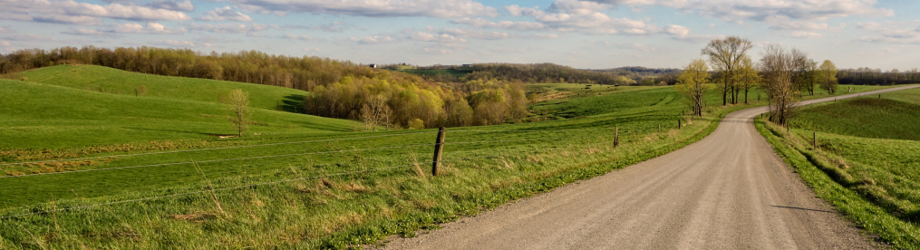
After a while going down alongside the Ohio River, I got rather bored, as there was not much to see from SR-7. So I cut across country a bit to the southwest. I ended up driving on a road which followed a tributary of the Ohio River (I think maybe Sunfish Creek). In so doing, I was introduced to a new phenomenon that I had not seen before.
At a number of places along this road property owners, whose houses were on the other side of the creek from the main road, had built narrow bridges across the stream. I suspect now, though I did not bother to look at the time, that their mailboxes were on the road, so they had to cross the creek to check their mail. However, in some cases, they could do so via a bridge meant for cars just a little further down, so it says something about their ideas of convenience that they decided they needed to have footbridges, too.
The footbridges I saw ranged from reasonably sturdy to far too rickety for my tastes. I have an inherent fear of heights—well, a fear of falling, really—and I just cannot imagine myself being able to step onto some of the bridges I saw.
The below image is one of the first such footbridges I came across. Notice how all these bridges don’t simply cross the creek but go well up and above the creek. I am not sure why, unless it is possibly to protect the bridges if the creek rises. 
Here’s another one. Look at how long and elaborate it is. Simply amazing. 

I came across the below old building purely by accident. I pulled into the driveway of this property to turn around—possibly to double back and get that bridge above, I can’t remember—when I noticed that in addition to some modern structures, it contained what was clearly a very old building indeed.
I googled the phone number on the sign in front and it said “Emory Rothenbuhler & Sons, Inc.,” and was some sort of trucking or hauling business. The sign over the porch of this old building says “Rothenbuhlers” on line one, “Tondas” on line two, and “Supper-Bed” on line three. It seems that some ancestor of the Rothenbulers ran an old boarding house or small inn here? It may be that the sign itself is more recent—I see a wedding announcement from the mid-1970s for a Tonda Jones and a Dean (son of Emory) Rothenbuhler. I’m curious what the history of this building is.


Maybe the footbridges are also for the kids to get to the highway to catch the bus.